
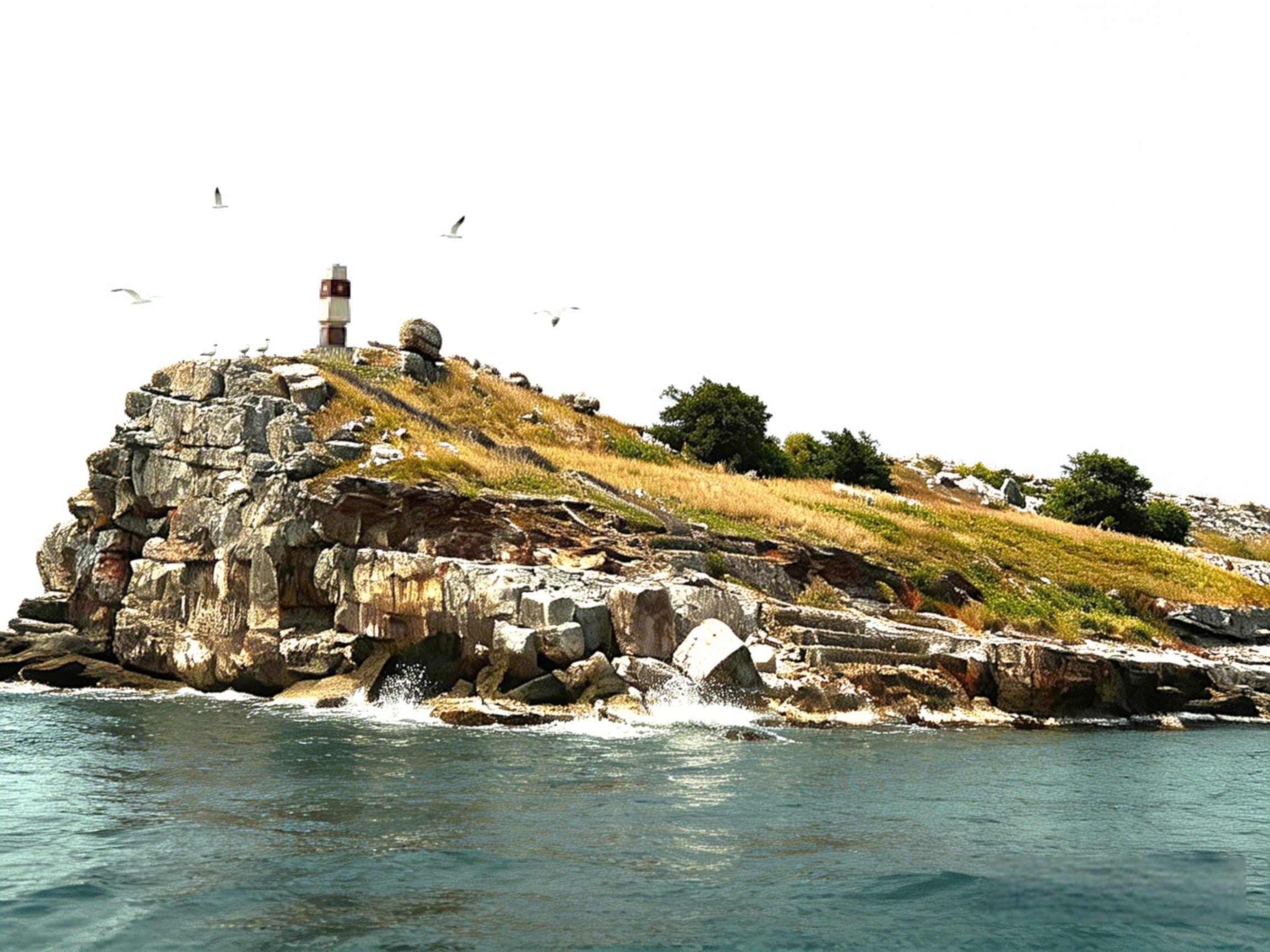
A1 – Hon Nhan (Tho Chau Archipelago, Kien Giang Province)
- Coordinates: 9°15′ N, 103°00′ E
- Province: Kien Giang (Phu Quoc district)
- Area: ~2,000m² | Max elevation: 40m above sea level
Hon Nhan marks Vietnam’s southwesternmost baseline point. Bare granite with no trees, it is named after the thousands of swiftlets that return each June to nest. Point A1 is the opening anchor of Vietnam’s entire southern baseline system.
A1 sovereignty marker on Hon Nhan Island in the Tho Chau Archipelago, Kien Giang Province.
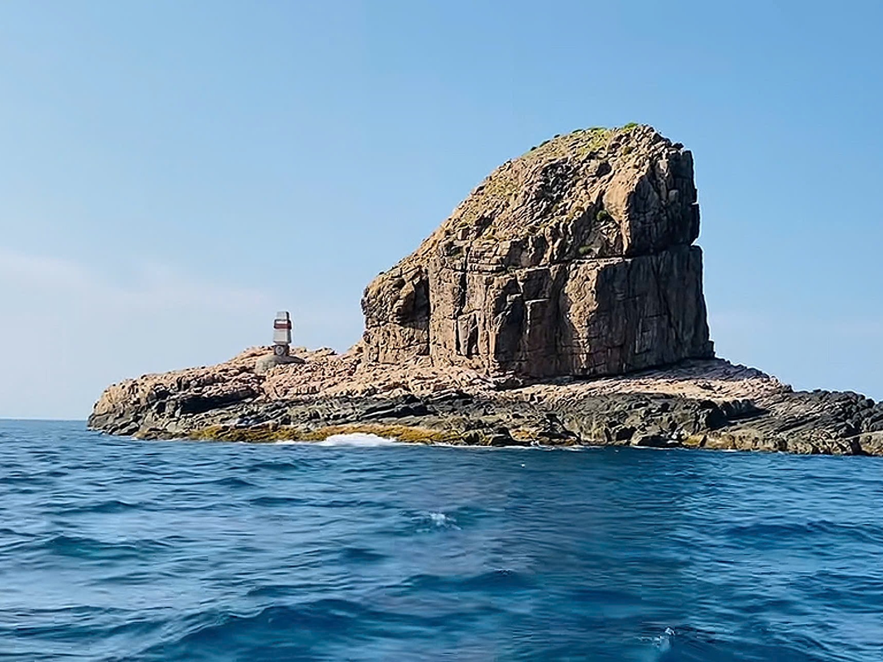
A2 – Hon Da Le (Kien Giang Province)
Dimensions:
- Length: ~120–130 m
- Width: ~30–35 m
- Height: ~6–7 m
- Geology: Rocky outcrop, no freshwater, no vegetation
A small volcanic islet near the Hon Khoai group. Two submerged reefs extend southwest and disappear at high tide. From here, all five islands of Hon Khoai (including the radar station and lighthouse on the main island) are visible.
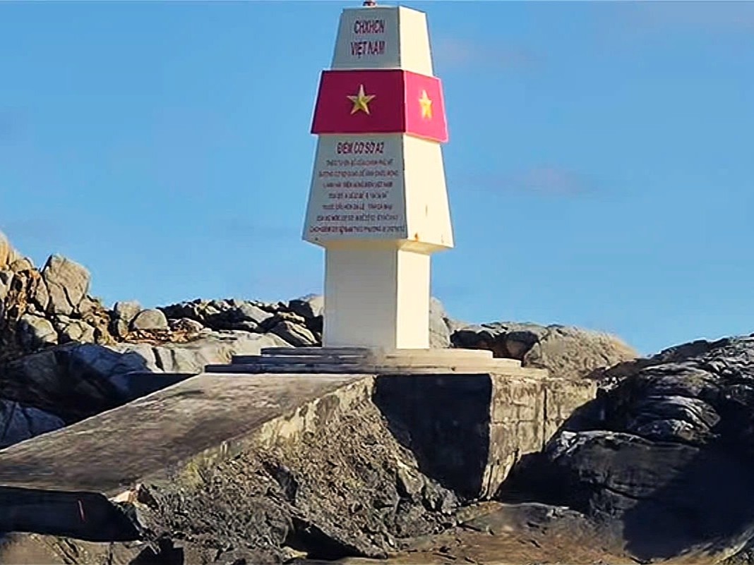
A2 sovereignty marker on Hon Da Le Island in Kien Giang Province, Vietnam
A3 – Hon Tai Lon (Con Dao Archipelago, Ba Ria – Vung Tau Province)
The first of three Con Dao baseline points. Hon Tai Lon has the most diverse terrain in the group: forest interior, rocky coastline, and intact surrounding reef. Overnight camping is permitted through national park programs.
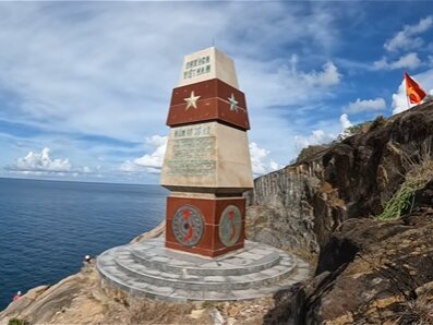
A3 sovereignty marker on Hon Tai Lon Island in the Con Dao Archipelago, Ba Ria – Vung Tau Province.
A4 – Hon Bong Lan (Con Dao Archipelago, Ba Ria – Vung Tau Province)
- Access: Stone staircase carved into the rock face from sea level to the monument
- Marine environment: Intact coral reef, suitable for snorkeling
The most easily accessible of the three Con Dao markers. The staircase cut directly into the cliff makes physical contact with the A4 monument straightforward even without technical climbing. Reef around the island is in good condition.
A4 sovereignty marker on Hon Bong Lan Island in the Con Dao Archipelago, Vietnam.
A5 – Hon Bay Canh / Bay Canh Island (Con Dao Archipelago, Ba Ria – Vung Tau Province)
- Landmark: Bay Canh Lighthouse – French colonial era, over 100 years old, still operational
- Sea turtle nesting: April–October (most active nesting site in the archipelago)
- Architecture note: The lighthouse dates from the French colonial period and remains operational today.
Hon Bay Canh is the most historically significant of the three Con Dao baseline markers. The lighthouse, built during the French colonial period, has operated for more than a century. The rocky coastline surrounding the A5 marker is among the most scenic in the outer Con Dao islands.
A5 sovereignty marker on Hon Bay Canh Island in Con Dao National Park.
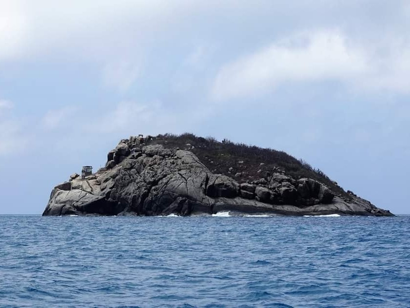
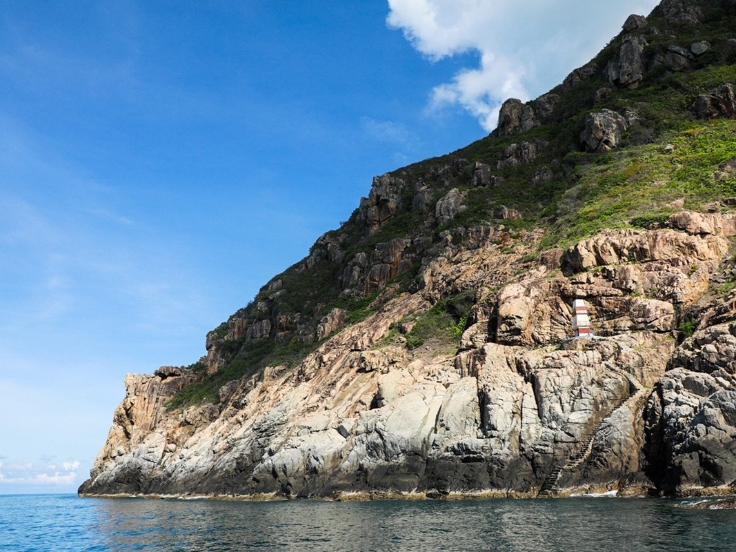
A6 – Hon Hai Island (Phu Quy District, Binh Thuan Province)
- Geology: Volcanic rock, no groundwater
- Water supply: Limited freshwater; rainwater collection affected by seabird contamination, so additional water must be transported from the mainland.
- Infrastructure: ~300m² reinforced building, 380m² dock, 423m² forecourt, 170m underground tunnel
Hon Hai is notable for its underground tunnel system connecting different sections of the lighthouse station – a practical solution to surface conditions that include strong winds and heavy bird presence. Lighthouse keepers climb to the lantern room daily and sleep directly below the light.
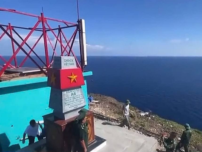
A6 sovereignty marker on Hon Hai Island in Phu Quy District, Binh Thuan Province.
A7 – Hon Doi (Khanh Hoa Province)
- Location: Less than 1 nautical mile from Vietnam’s easternmost mainland point
- Administration: Khanh Hoa Bird’s Nest Company (swiftlet nest harvesting + maritime security)
Defined by massive granite boulders carved into unusual shapes over geological time. Approximately 10–15 minutes by boat from the Mui Doi area near Dam Mon Peninsula. 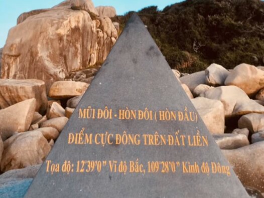
A7 sovereignty marker near Hon Doi in Khanh Hoa Province, close to Mui Doi.
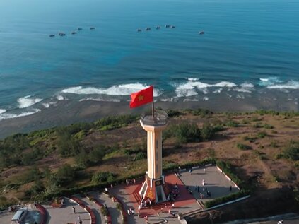
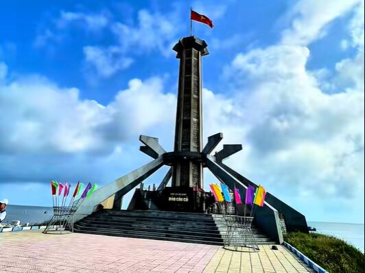
A8 – Mui Dai Lanh/ Cape Dai Lanh (Phu Yen Province)
- Geographic significance: First point on Vietnamese soil to receive sunrise each day
- Landmark: Dai Lanh Lighthouse – French colonial construction, active, cliffside position
Mui Dai Lanh is Vietnam’s easternmost baseline point and the location where sunlight first touches the country each morning. The lighthouse is climbable; arriving before dawn to watch sunrise from the lantern room is a well-documented experience among travelers to Phu Yen.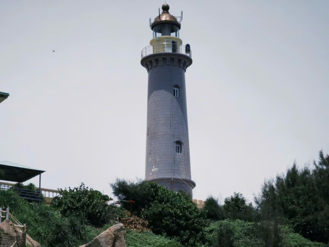
A8 sovereignty marker at Mui Dai Lanh (Cape Dai Lanh) in Phu Yen Province.
A9 – Hon Ong Can (Binh Dinh Province)
- Structure: Chain of three connected islands; A9 marker on the farthest
- Terrain: Central rock rises 20+ meters; deep fissure creates permanent surge channel
- Access: Landing is possible on calm days, but the rocky shoreline makes approach difficult.
The A9 monument sits atop a naturally dramatic formation – the 20-meter rock is visually a sovereignty marker on its own before the official monument is even considered.
A9 sovereignty marker on Hon Ong Can Island off the coast of Binh Dinh Province.
A10 – Ly Son Island (Quang Ngai Province)
- Historical significance: Home base of the Hoang Sa Flotilla – Vietnam’s historical maritime patrol force for the Paracel Islands
- Transport: High-speed ferry from Sa Ky port, Quang Ngai (~30 minutes)
- Notable product: Ly Son garlic – grown in volcanic soil, considered the finest in Vietnam
Ly Son’s connection to Vietnamese maritime history predates the 1982 baseline declaration by centuries. Soldiers from the Hoang Sa Flotilla – commissioned under the Nguyen Lords to patrol and document the Paracel Islands – were predominantly from Ly Son. Many are buried on the island.
A10 sovereignty marker on Ly Son Island in Quang Ngai Province.
A11 – Con Co Island (Quang Tri Province)
- Coordinates: 17°10′ N, 107°21′ E
- Distance from mainland: 27km east of Mui Lay
- Area: ~4km²
- Province: Quang Tri
Con Co is the northernmost point in Vietnam’s southern baseline system, established in 1982. The island sits about 27 km off the coast of Quang Tri and covers roughly 4 km². Because of its position near the entrance to the Gulf of Tonkin, Con Co has long played an important role in monitoring maritime activity in this part of the sea.
A11 sovereignty marker on Con Co Island in Quang Tri Province.
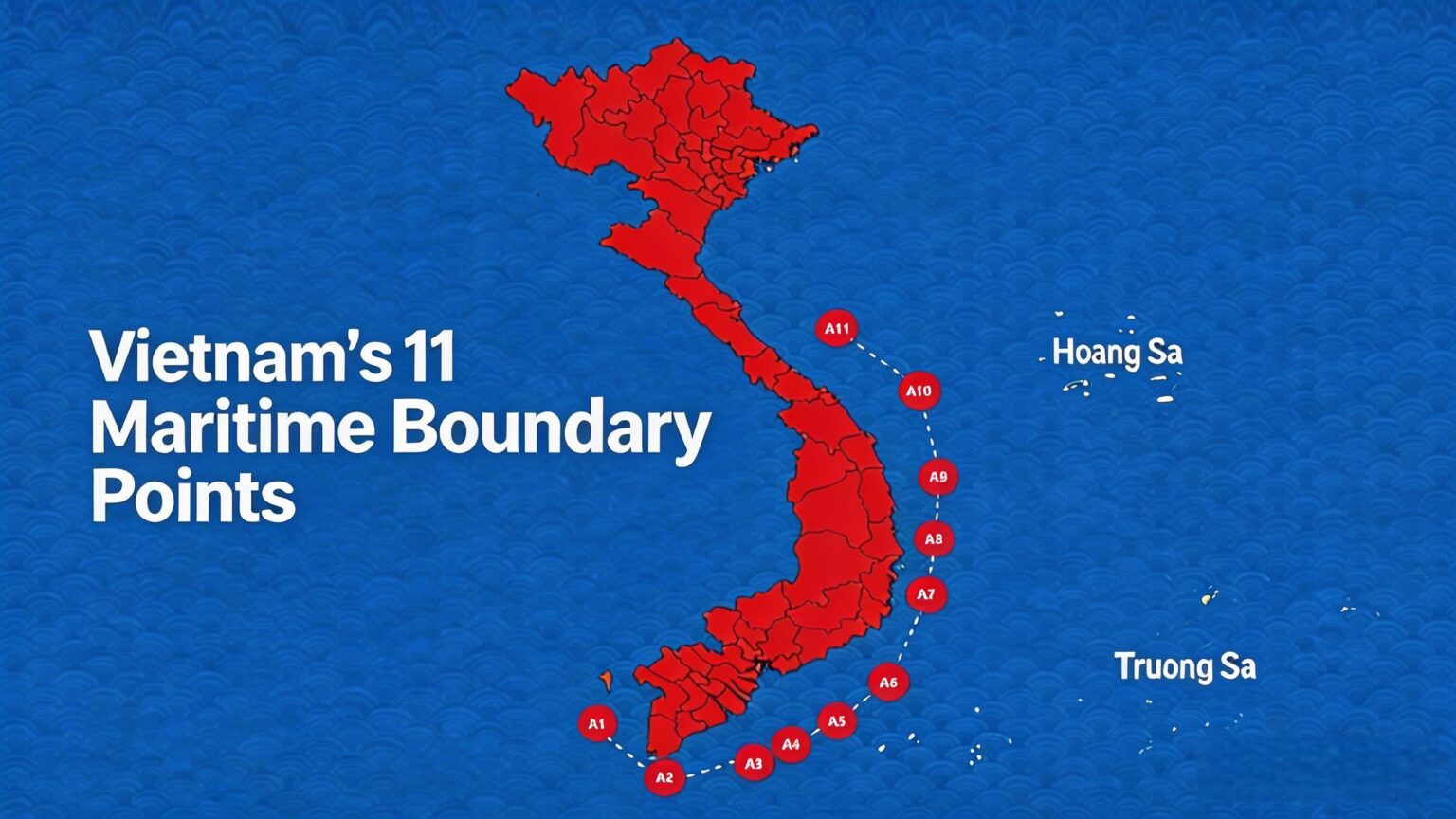
The eleven baseline points form the official straight baseline system declared by Vietnam on November 12, 1982, used to measure the country’s territorial sea under the United Nations Convention on the Law of the Sea (UNCLOS).
Con Dao Dive Center has operated in the archipelago for over 15 years with a consistent focus on small-group diving and national park compliance.
We maintain a maximum of 4–6 divers per guide – a deliberate limit that supports both safety and reef integrity. All instructors hold international certifications (PADI or SSI) with direct familiarity with local site conditions.
Our Diving Services in Con Dao:
- Discover Scuba Diving – no certification required; guided entry-level dives
- Open Water Course – full PADI/SSI certification for beginners
- Advanced Open Water Course – next-level training for certified OW divers
- Fun Dives – guided dives for certified divers at all experience levels
- Snorkeling Tours – including routes near the A3–A5 baseline markers
- Freediving – fun and coached sessions following Molchanovs standards
If you are planning a Con Dao trip and want to combine the outer island and baseline point tour with diving, contact us to align schedules. booking@divecondao.com